Learn More About GIS
GIS Overview
A Geographic Information System (GIS) is a framework for gathering, managing and analyzing data with spatial components. Enterprise GIS (EGIS) is an integrated system of software and data that combines master versions of maps & floor plans with any type of geo-located departmental data to enhance understanding & decision-making across an institution.
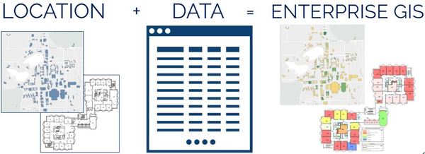
A simple way to think about EGIS is as an "equation". We take master versions of maps and floor plans and combine that with important data about spaces, assets, utilization rates, etc and make it easy to access and understand.
Examples of EGIS applications include:
- Easy, secure access to master versions of University maps and floor plans
- Quick & easy identification of departmental space assignments - including unallocated / over-allocated office spaces
- Efficient, user-friendly management of assets both inside and outside of University buildings.
- Custom applications to meet unique departmental needs.
- Examples could include the integration of utilization information to visualize the use of specific spaces (e.g. - conference rooms), the use of mobile-friendly tools to support inspection data collection and much more!